
Travel route planning is an important step for a tourist to prepare his/her trip. As a common scenario, a tourist usually asks the following questions when he/she is planning his/her trip in an unfamiliar place:
- Are there any travel route suggestions for a one-day or three-day trip in Beijing?
- What is the most popular travel path within the Forbidden City? To facilitate a tourist’s trip planning, in this paper, we target at solving the problem of automatic travel route planning.
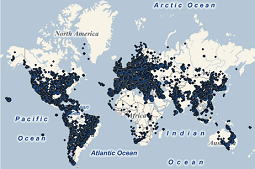
We propose to leverage existing travel clues recovered from 20 million geo-tagged photos collected from www.panoramio.com to suggest customized travel route plans according to users’ preferences. As the footprints of tourists at memorable destinations, the geotagged photos could be naturally used to discover the travel paths within a destination (attractions/landmarks) and travel routes between destinations. Based on the information discovered from geo-tagged photos, we can provide a customized trip plan for a tourist, i.e., the popular destinations to visit, the visiting order of destinations, the time arrangement in each destination, and the typical travel path within each destination. Users are also enabled to specify personal preference such as visiting location, visiting time/season, travel duration, and destination style in an interactive manner to guide the system. Owning to 20 million geo-tagged photos and 200; 000 travelogues, an online system has been developed to help users plan travel routes for over 30; 000 attractions/landmarks in more than 100 countries and territories. Experimental results show the intelligence and effectiveness of the proposed framework.