
Windflow: Airplanes as Vast Sensor Network
Please note that Windflow research is concluded. The APIs, website or access to any project data is no longer supported. Below is the original content describing the project available for the reference purposes only.
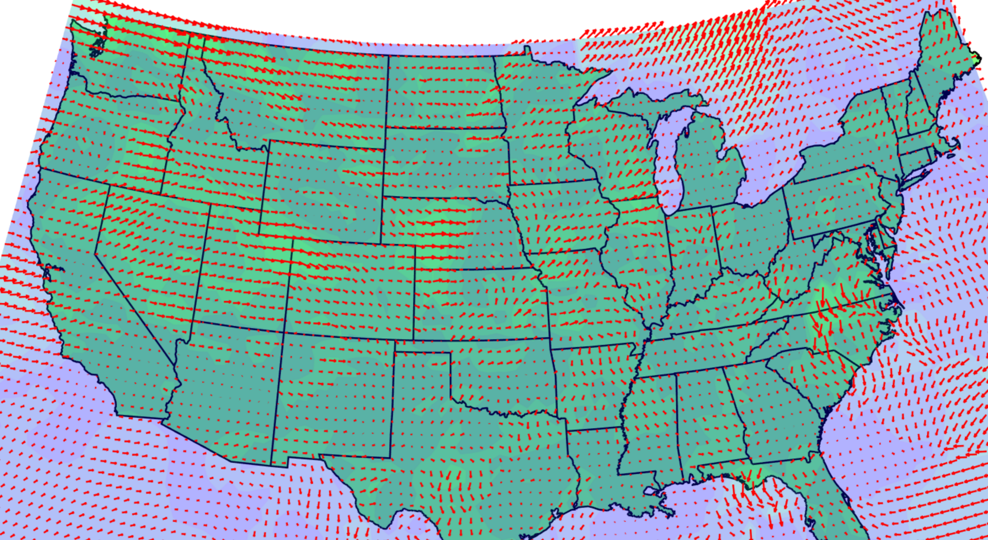
The best available weather forecasts in the United States—from the federal government’s Winds Aloft (opens in new tab) program—have been based largely on data from instrumented weather balloons released twice a day, providing forecasts for 176 stations across the United States. Winds Aloft is often not accurate and uses time and fuel resources. The Windflow project explores the research question: Could airplanes in flight be employed as a vast sensor network to determine atmospheric conditions? Could data available today be used to infer winds on a large scale without special plane-based wind sensors and new infrastructure to access and combine signals from planes?
Because winds will change an aircraft’s flight path and affect the groundspeed, it is indeed possible to estimate the wind conditions mathematically. However one key piece of data was unavailable: The data provided by the FAA does not include information about where a plane is headed. Solving this conundrum is one of the most significant contributions of this project. Apparently winds exhibit a special property known as spatial regularity—that is, nearby airplanes are likely to encounter similar winds. It is possible to exploit this property by taking observations from nearby wind stations, combining it with the FAA data, and then using a probabilistic model to infer the wind velocity.
People
Eric Horvitz
Chief Scientific Officer